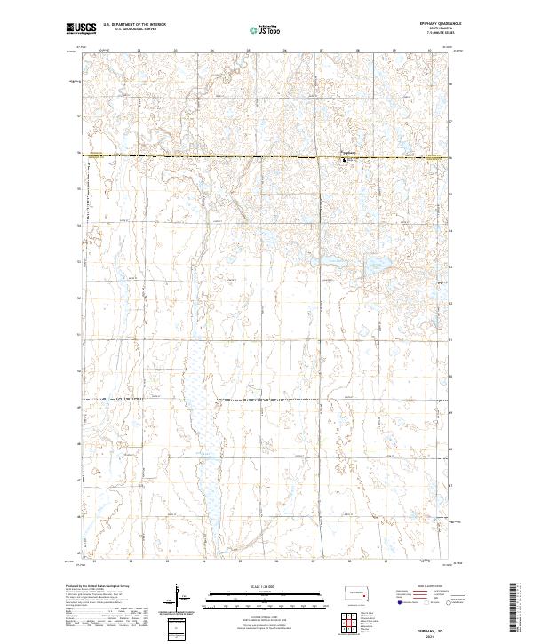
2021 Map of Epiphany
USGS Topo · Published 2021About this map
Epiphany sits at the northern edge of this prairie landscape, marking the transition between Miner and Hanson counties. The town serves as a focal point in a region dominated by a strict section-line road grid, including 244th St and 427th Ave, which defines the agricultural layout of the early 21st century. This survey records the vital water resources of the James River basin, specifically the elongated basin of Long Lake and the smaller Lutz Lake and Spring Lake. The inclusion of the Holy Three Kings Cem provides a specific point of interest for genealogists tracing local families. These wetlands and drainage systems, including Pierre Cr and Johnson Cr, illustrate the subtle topography that dictates the placement of farms and transit routes across these townships.
Find a feature on this map
31 named features on this map. Tap any name to fly to it.
Don’t see what you’re looking for? This feature index may not catch every label — zoom into the map to look around manually.
Map Details
Editions of this 2021 Epiphany Map
This is the sole edition of this map. No revisions or reprints were ever made.
Other maps of this area

1899 · Alexandria
USGS Topo · 1:125,000

1955 · Sioux Falls
USGS Topo · 1:250,000

1957 · Alexandria
USGS Topo · 1:24,000

1958 · Sioux Falls
USGS Topo · 1:250,000
1973 · Morris Lake
USGS Topo · 1:24,000

1973 · Ness Chain Lakes
USGS Topo · 1:24,000

1973 · Farmer
USGS Topo · 1:24,000

1973 · Canova SE
USGS Topo · 1:24,000
1973 · Spencer
USGS Topo · 1:24,000
1973 · Bitter Lake
USGS Topo · 1:24,000
Featured Places
- Edgerton Township, SD
- Fairview Township, SD
- Rock Creek Township, SD
- Beaver Township, SD
- Jasper Township, SD