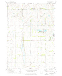
1973 Map of Epiphany
USGS Topo · Published 1978About this map
Epiphany sits at the border of Miner and Hanson Counties, serving as a focal point for this agrarian landscape during the early 1970s. The region is defined by an extensive network of prairie wetlands and water bodies, most notably the elongated reach of Long Lake and the smaller Lutz Lake and Spring Lake. These natural features are integrated into conservation and recreation zones, including the Long Lake State Public Shooting Area and the National Waterfowl Production Area. The terrain is drained by several meandering watercourses such as Rock Creek, Johnson Creek, and Pierre Creek, which cut through the townships of Beaver, Rock Creek, and Fairview. The map also documents localized industrial activity with scattered Gravel Pits, reflecting the literal foundations of the area's rural road network.
Find a feature on this map
18 named features on this map. Tap any name to fly to it.
Don’t see what you’re looking for? This feature index may not catch every label — zoom into the map to look around manually.
Map Details
Editions of this 1973 Epiphany Map
This is the sole edition of this map. No revisions or reprints were ever made.
Other maps of this area

1899 · Alexandria
USGS Topo · 1:125,000

1955 · Sioux Falls
USGS Topo · 1:250,000

1957 · Alexandria
USGS Topo · 1:24,000

1958 · Sioux Falls
USGS Topo · 1:250,000
1973 · Morris Lake
USGS Topo · 1:24,000

1973 · Ness Chain Lakes
USGS Topo · 1:24,000

1973 · Farmer
USGS Topo · 1:24,000

1973 · Canova SE
USGS Topo · 1:24,000
1973 · Spencer
USGS Topo · 1:24,000
1973 · Bitter Lake
USGS Topo · 1:24,000
Featured Places
- Beaver Township, SD
- Edgerton Township, SD
- Fairview Township, SD
- Spring Lake Township, SD
- Rock Creek Township, SD