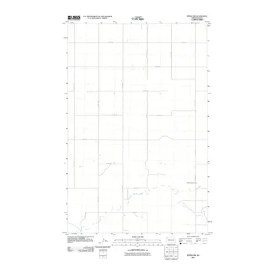
2011 Map of Epping NW
USGS Topo · Published 2011About this map
The East Fork Little Muddy River winds through the southern reaches of this Williams County landscape, defining the local hydrology in a region characterized by a vast section-line road grid. The presence of the Bethany Valley Cemetery in the southeast serves as a focal point for genealogical interest, representing a enduring landmark in this agricultural corridor. Transport and access are anchored by County Hwy 11, which runs north-south through the center of the survey. The grid of local routes, including 127th Ave NW and 71st St NW, reflects the late 20th and early 21st-century rural land management patterns common to North Dakota, where topographic relief is minimal and the terrain is almost entirely organized by the Public Land Survey System.
Find a feature on this map
16 named features on this map. Tap any name to fly to it.
Don’t see what you’re looking for? This feature index may not catch every label — zoom into the map to look around manually.
Map Details
Editions of this 2011 Epping NW Map
This is the sole edition of this map. No revisions or reprints were ever made.
Other maps of this area

1911 · Ray
USGS Topo · 1:125,000

1953 · Williston
USGS Topo · 1:250,000

1957 · Williston
USGS Topo · 1:250,000

1959 · Marmon SE
USGS Topo · 1:24,000

1974 · Twin Lakes
USGS Topo · 1:24,000

1977 · Appam
USGS Topo · 1:24,000

1977 · Alamo
USGS Topo · 1:24,000

1978 · Corinth
USGS Topo · 1:24,000

1978 · Epping NW
USGS Topo · 1:24,000
1978 · Epping NE
USGS Topo · 1:24,000