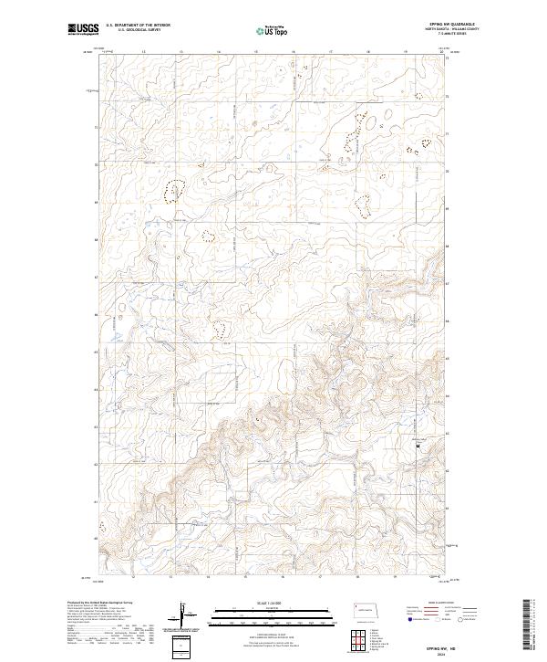
2024 Map of Epping NW
USGS Topo · Published 2024About this map
The Bethany Valley Cem stands as a quiet focal point in this portion of Williams County, located in the southeastern quadrant of the survey area. The landscape is defined by a rigorous section-line road network typical of the High Plains, where routes like Co Hwy 11 and 127th Ave NW carve out the administrative boundaries of t158n r99w and t157n r98w. These straight corridors, including 74th St NW and Co 10, reveal a systematic approach to land management and rural access. The terrain itself exhibits a complex series of coulees and drainage patterns that interrupt the flat agricultural grid, particularly visible in the south where 68th St NW and 67th St NW navigate the changing elevation. This record provides a clear look at the persistent rural infrastructure and land use in western North Dakota.
Find a feature on this map
21 named features on this map. Tap any name to fly to it.
Don’t see what you’re looking for? This feature index may not catch every label — zoom into the map to look around manually.
Map Details
Editions of this 2024 Epping NW Map
This is the sole edition of this map. No revisions or reprints were ever made.
Other maps of this area

1911 · Ray
USGS Topo · 1:125,000

1953 · Williston
USGS Topo · 1:250,000

1957 · Williston
USGS Topo · 1:250,000

1959 · Marmon SE
USGS Topo · 1:24,000

1974 · Twin Lakes
USGS Topo · 1:24,000

1977 · Appam
USGS Topo · 1:24,000

1977 · Alamo
USGS Topo · 1:24,000

1978 · Corinth
USGS Topo · 1:24,000

1978 · Epping NW
USGS Topo · 1:24,000
1978 · Epping NE
USGS Topo · 1:24,000