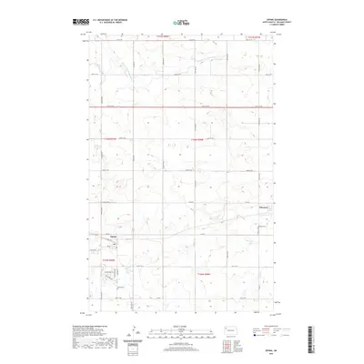
2020 Map of Epping
USGS Topo · Published 2020About this map
Epping sits at the heart of this Williams County landscape, where the prairie is etched by the drainage of Stony Cr. The town's layout is defined by a grid including Front St and 2nd St, with more recent residential expansions like Epping Ranch St and Stony Creek Trl pushing south toward the Epping Cem. To the east, the small settlement of Wheelock occupies a position near the Wheelock Cem, reflecting the sparse but enduring settlement pattern of the North Dakota plains.
Find a feature on this map
28 named features on this map. Tap any name to fly to it.
Don’t see what you’re looking for? This feature index may not catch every label — zoom into the map to look around manually.
Map Details
Editions of this 2020 Epping Map
This is the sole edition of this map. No revisions or reprints were ever made.
Other maps of this area

1911 · Ray
USGS Topo · 1:125,000

1953 · Williston
USGS Topo · 1:250,000

1957 · Williston
USGS Topo · 1:250,000

1969 · Cussicks Spring
USGS Topo · 1:24,000

1978 · Ray
USGS Topo · 1:24,000

1978 · Epping NW
USGS Topo · 1:24,000

1978 · Ray NW
USGS Topo · 1:24,000
1978 · Epping NE
USGS Topo · 1:24,000

1978 · Epping
USGS Topo · 1:24,000

1978 · Spring Brook
USGS Topo · 1:24,000