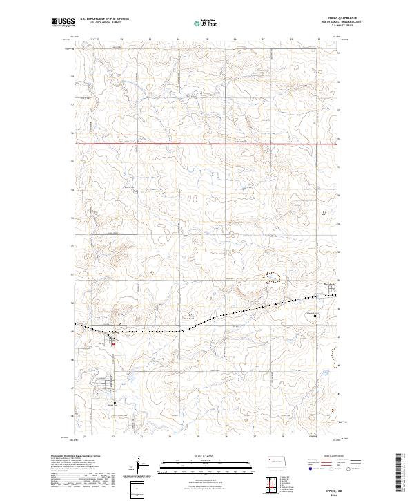
2024 Map of Epping
USGS Topo · Published 2024About this map
Epping and Wheelock anchor this Williams County landscape, serving as the primary nodes of settlement amidst a vast grid of section lines and gravel roads. The terrain is defined by the winding course of the East Fork Little Muddy River in the north and the drainage of Stony Creek further south. Genealogists and local historians will find significant value in the documentation of the Epping Cem and Wheelock Cem, which reflect the community's ancestral roots in this high plains region. The town of Epping remains the local center of activity, with its Po and core street network, including Front St and 2nd St, clearly delineated. The mapping of the surrounding section lines, such as Co RD 8 and Co Hwy 42, illustrates the persistent township-and-range land management system that has structured North Dakota agriculture for generations.
Find a feature on this map
38 named features on this map. Tap any name to fly to it.
Don’t see what you’re looking for? This feature index may not catch every label — zoom into the map to look around manually.
Map Details
Editions of this 2024 Epping Map
This is the sole edition of this map. No revisions or reprints were ever made.
Other maps of this area

1911 · Ray
USGS Topo · 1:125,000

1953 · Williston
USGS Topo · 1:250,000

1957 · Williston
USGS Topo · 1:250,000

1969 · Cussicks Spring
USGS Topo · 1:24,000

1978 · Ray
USGS Topo · 1:24,000

1978 · Epping NW
USGS Topo · 1:24,000

1978 · Ray NW
USGS Topo · 1:24,000
1978 · Epping NE
USGS Topo · 1:24,000

1978 · Epping
USGS Topo · 1:24,000

1978 · Spring Brook
USGS Topo · 1:24,000