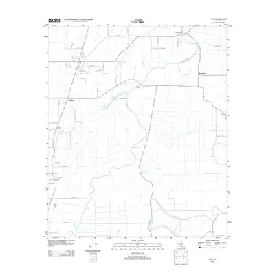
2012 Map of Epps
USGS Topo · Published 2012About this map
Bayou Macon winds through the center of this West Carroll Parish landscape, serving as a primary geographic anchor for the communities of Epps and Monticello. The map reveals a highly structured drainage and transport network defined by agricultural land use, with secondary settlements like Mitchiner and Warden situated along established parish roads. The presence of several hunting or fishing retreats, including Jackson Lodge, Mayburn Lodge, and Mackey Lodge, suggests the importance of the bayou and its surrounding wetlands for local recreation and sport. This 2012 survey also documents important sites for family historians, including Palestine Cem, Fairview Cem, and Seven Star Cem, which are scattered among the grid-patterned fields. From the small-town streets of Epps to the remote stretch of Epps Landing, the map provides a clear view of the region's rural character and its reliance on the complex water systems of Joes Bayou and Cypress Bayou.
Find a feature on this map
63 named features on this map. Tap any name to fly to it.
Don’t see what you’re looking for? This feature index may not catch every label — zoom into the map to look around manually.
Map Details
Editions of this 2012 Epps Map
This is the sole edition of this map. No revisions or reprints were ever made.
Other maps of this area

1935 · Baskinton
USGS Topo · 1:62,500

1935 · Hurricane
USGS Topo · 1:62,500

1935 · Waverly
USGS Topo · 1:62,500

1955 · Jackson
USGS Topo · 1:250,000

1958 · Baskinton
USGS Topo · 1:62,500

1958 · Hurricane
USGS Topo · 1:62,500

1959 · Mitchiner
USGS Topo · 1:62,500

1961 · Jackson
USGS Topo · 1:250,000

1961 · Waverly
USGS Topo · 1:62,500

1962 · Jackson
USGS Topo · 1:250,000