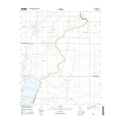
2015 Map of Epps
USGS Topo · Published 2015About this map
Epps and Monticello anchor this North Louisiana landscape, where the meandering course of Joes Bayou and Cypress Bayou dictates the local geography. The map reveals a transition between West Carroll, Richland, and Madison parishes, characterized by a grid of agricultural roads and scattered settlements. Local heritage is preserved at several burial grounds, including Palestine Cem near the town of Mitchiner and Seven Star Cem farther south. The region's hydrography is defined by a complex network of slow-moving waterways such as Alligator Bayou and Cow Bayou, which historically influenced the drainage and settlement patterns of this deltaic plain. Tracing the intersections of historic parish boundaries and local routes like Ozie Starks Rd provides a detailed look at the rural infrastructure and land use established in the early 21st century.
Find a feature on this map
50 named features on this map. Tap any name to fly to it.
Don’t see what you’re looking for? This feature index may not catch every label — zoom into the map to look around manually.
Map Details
Editions of this 2015 Epps Map
This is the sole edition of this map. No revisions or reprints were ever made.
Other maps of this area

1935 · Baskinton
USGS Topo · 1:62,500

1935 · Hurricane
USGS Topo · 1:62,500

1935 · Waverly
USGS Topo · 1:62,500

1955 · Jackson
USGS Topo · 1:250,000

1958 · Baskinton
USGS Topo · 1:62,500

1958 · Hurricane
USGS Topo · 1:62,500

1959 · Mitchiner
USGS Topo · 1:62,500

1961 · Jackson
USGS Topo · 1:250,000

1961 · Waverly
USGS Topo · 1:62,500

1962 · Jackson
USGS Topo · 1:250,000