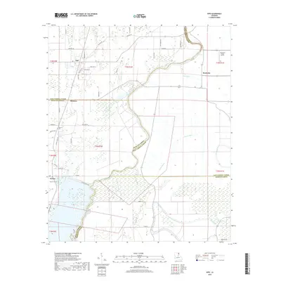
2018 Map of Epps
USGS Topo · Published 2018About this map
Bayou Macon carves a sinuous path through this Northeast Louisiana landscape, serving as a natural boundary between West Carroll, Richland, East Carroll, and Madison parishes. The settlement of Epps sits at a crossroads in the northwest, characterized by a structured grid of local streets like Woodlawn St and Locust St. Agricultural patterns dominate the region, with drainage provided by an extensive network of waterways including Alligator Bayou, Cypress Bayou, and Joes Bayou.
Find a feature on this map
55 named features on this map. Tap any name to fly to it.
Don’t see what you’re looking for? This feature index may not catch every label — zoom into the map to look around manually.
Map Details
Editions of this 2018 Epps Map
This is the sole edition of this map. No revisions or reprints were ever made.
Other maps of this area

1935 · Baskinton
USGS Topo · 1:62,500

1935 · Hurricane
USGS Topo · 1:62,500

1935 · Waverly
USGS Topo · 1:62,500

1955 · Jackson
USGS Topo · 1:250,000

1958 · Baskinton
USGS Topo · 1:62,500

1958 · Hurricane
USGS Topo · 1:62,500

1959 · Mitchiner
USGS Topo · 1:62,500

1961 · Jackson
USGS Topo · 1:250,000

1961 · Waverly
USGS Topo · 1:62,500

1962 · Jackson
USGS Topo · 1:250,000