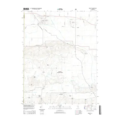
2015 Map of Equality
USGS Topo · Published 2015About this map
The Saline River and its North Fork divide this landscape, which transitions from the northern flats around Equality into the rising terrain of the Wildcat Hills. This area of Southern Illinois is characterized by numerous family and community landmarks, such as Elmwood Cem, Level Hill Cem, and Hickory Hill Catholic Cem. To the south, the Shawnee National Forest encompasses a rugged network of hollows, including Poplar Hollow, Burnt Shanty Hollow, and Pounds Hollow. Small settlements like Kedron, Leamington, and Gibsonia are connected by a grid of named roads like High Knob Rd and Shawnee Forest Rd. The map provides a look at the drainage patterns of Eagle Creek and Lawler Ditch, reflecting the historic agricultural and timber-based economy of Gallatin County.
Find a feature on this map
56 named features on this map. Tap any name to fly to it.
Don’t see what you’re looking for? This feature index may not catch every label — zoom into the map to look around manually.
Map Details
Editions of this 2015 Equality Map
This is the sole edition of this map. No revisions or reprints were ever made.
Other maps of this area

1905 · Eldorado
USGS Topo · 1:62,500

1905 · New Haven
USGS Topo · 1:62,500

1906 · New Haven
USGS Topo · 1:62,500

1906 · Eldorado
USGS Topo · 1:62,500

1916 · Shawneetown
USGS Topo · 1:62,500

1916 · Equality
USGS Topo · 1:62,500

1949 · Paducah
USGS Topo · 1:250,000

1949 · New Haven
USGS Topo · 1:62,500

1950 · Paducah
USGS Topo · 1:250,000

1954 · Paducah
USGS Topo · 1:250,000