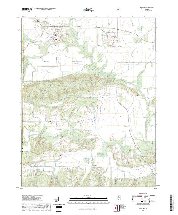
2024 Map of Equality
USGS Topo · Published 2024About this map
The Saline River and its North Fork converge near the village of Equality, a landscape where the river bottomlands transition abruptly into the southern Illinois uplands. This area of Gallatin and Saline counties is defined by the Wildcat Hills and the deep drainage patterns of the Shawnee National Forest, including numerous named hollows such as Poplar Hollow and Burnt Shanty Hollow. For genealogists, the map preserves the locations of several community burial grounds, including the Village Cem, Leamington Cem, and the remote Lloyd Cem. Small rural centers like Kedron and Leamington serve as landmarks in a territory once heavily influenced by the regional mining industry, evidenced here by Eagle Mine Rd. The terrain is deeply dissected by creeks such as Eagle Creek and Little Eagle Creek, which carve through the high ridges of the Shawnee Hills.
Find a feature on this map
67 named features on this map. Tap any name to fly to it.
Don’t see what you’re looking for? This feature index may not catch every label — zoom into the map to look around manually.
Map Details
Editions of this 2024 Equality Map
This is the sole edition of this map. No revisions or reprints were ever made.
Other maps of this area

1905 · Eldorado
USGS Topo · 1:62,500

1905 · New Haven
USGS Topo · 1:62,500

1906 · New Haven
USGS Topo · 1:62,500

1906 · Eldorado
USGS Topo · 1:62,500

1916 · Shawneetown
USGS Topo · 1:62,500

1916 · Equality
USGS Topo · 1:62,500

1949 · Paducah
USGS Topo · 1:250,000

1949 · New Haven
USGS Topo · 1:62,500

1950 · Paducah
USGS Topo · 1:250,000

1954 · Paducah
USGS Topo · 1:250,000