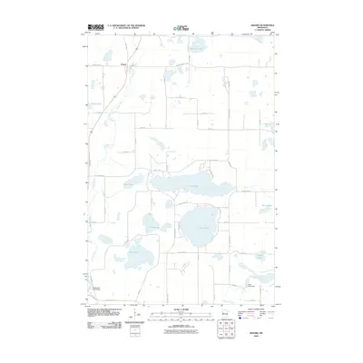
2010 Map of Erhard
USGS Topo · Published 2010About this map
Erhard sits along the Pelican River in a landscape dominated by glacial lakes and watercourses. This survey reveals a complex hydrographic network where the river winds past Knobel Lake and Reed Lake before continuing south. The area’s geography is defined by its numerous named basins, from the large expanse of Lake Jewett and Lake Mason to the smaller Devils Lake and Wolf Lake.
Find a feature on this map
48 named features on this map. Tap any name to fly to it.
Don’t see what you’re looking for? This feature index may not catch every label — zoom into the map to look around manually.
Map Details
Editions of this 2010 Erhard Map
This is the sole edition of this map. No revisions or reprints were ever made.
Other maps of this area

1912 · Vergas
USGS Topo · 1:62,500

1913 · Fergus Falls
USGS Topo · 1:62,500

1914 · Pelican Rapids
USGS Topo · 1:62,500

1915 · Underwood
USGS Topo · 1:62,500

1915 · Vergas
USGS Topo · 1:62,500

1917 · Pelican Rapids
USGS Topo · 1:62,500

1953 · Fargo
USGS Topo · 1:250,000

1953 · Brainerd
USGS Topo · 1:250,000

1956 · Fargo
USGS Topo · 1:250,000

1957 · Brainerd
USGS Topo · 1:250,000