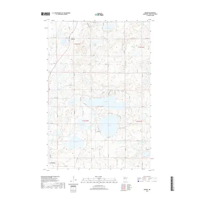
2019 Map of Erhard
USGS Topo · Published 2019About this map
Erhard and Elizabeth sit at the northern and southern edges of this lake-dotted region in Otter Tail County. The landscape is defined by its dense concentration of glacial basins, including the expansive waters of Long Lake and Lake Jewett. In the northwest, the Pelican River flows through the area, while the Otter Tail River cuts across the southeast corner. The drainage pattern here is particularly intricate, with Reed Cr connecting several smaller bodies of water like Reed Lake and Lake Mason. Historically, the settlement of Erhard developed along Fergus Ave, serving as a focal point for the surrounding rural roads that navigate the complex topography. The map reveals the extensive network of township roads, such as Co Rd 22 and Jewett Lake Rd, which provide access to the various shorelines and agricultural tracts that dominate the county's interior.
Find a feature on this map
41 named features on this map. Tap any name to fly to it.
Don’t see what you’re looking for? This feature index may not catch every label — zoom into the map to look around manually.
Map Details
Editions of this 2019 Erhard Map
This is the sole edition of this map. No revisions or reprints were ever made.
Other maps of this area

1912 · Vergas
USGS Topo · 1:62,500

1913 · Fergus Falls
USGS Topo · 1:62,500

1914 · Pelican Rapids
USGS Topo · 1:62,500

1915 · Underwood
USGS Topo · 1:62,500

1915 · Vergas
USGS Topo · 1:62,500

1917 · Pelican Rapids
USGS Topo · 1:62,500

1953 · Fargo
USGS Topo · 1:250,000

1953 · Brainerd
USGS Topo · 1:250,000

1956 · Fargo
USGS Topo · 1:250,000

1957 · Brainerd
USGS Topo · 1:250,000