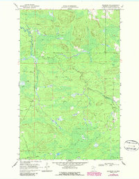
1969 Map of Ericsburg SE
USGS Topo · Published 1987About this map
Beaver Brook and Ester Brook wind through this Koochiching County landscape, defining a terrain shaped by seasonal drainage and northern wetlands. This 1969 survey, photorevised in the 1980s, reveals a specialized infrastructure designed for the cold climate, most notably the extensive network of the Winter Trail. These paths were critical for movement through the low-lying areas when the ground was frozen, providing access to remote timber or mineral resources that would otherwise be inaccessible during warmer months.
Find a feature on this map
5 named features on this map. Tap any name to fly to it.
Don’t see what you’re looking for? This feature index may not catch every label — zoom into the map to look around manually.
Map Details
Editions of this 1969 Ericsburg SE Map
2 editions found
Other maps of this area

1954 · International Falls
USGS Topo · 1:250,000

1957 · International Falls
USGS Topo · 1:250,000

1958 · International Falls
USGS Topo · 1:250,000

1969 · Ericsburg NW
USGS Topo · 1:24,000

1969 · Ericsburg
USGS Topo · 1:24,000

1969 · Ericsburg SE
USGS Topo · 1:24,000

1969 · Ray
USGS Topo · 1:24,000

1969 · Ray SW
USGS Topo · 1:24,000

1969 · Ericsburg SW
USGS Topo · 1:24,000
1970 · Nett Lake River East
USGS Topo · 1:24,000