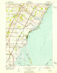
1952 Map of Erie
USGS Topo · Published 1953About this map
Lake Erie defines the eastern edge of this coastal survey, where a series of residential beach communities like Avalon Beach, Grand View, and North Shores line the waterfront. The landscape is heavily influenced by its proximity to the lake, featuring a complex network of drainage systems such as Cousino Drain and Erie Drain to manage the low-lying terrain. Further south, the Woodtick Peninsula and Erie Marsh Game Area represent significant natural preserves along Maumee Bay, punctuated by the Old Lighthouse at Turtle Island near the Michigan-Ohio state line.
Find a feature on this map
64 named features on this map. Tap any name to fly to it.
Don’t see what you’re looking for? This feature index may not catch every label — zoom into the map to look around manually.
Map Details
Editions of this 1952 Erie Map
3 editions found
Other maps of this area

1900 · Maumee Bay
USGS Topo · 1:62,500

1900 · Toledo
USGS Topo · 1:62,500

1912 · Monroe
USGS Topo · 1:62,500

1912 · Dundee
USGS Topo · 1:62,500

1914 · Monroe
USGS Topo · 1:62,500

1926 · Dundee
USGS Topo · 1:62,500

1927 · Monroe
USGS Topo · 1:31,680

1934 · Reno Beach
USGS Topo · 1:24,000

1934 · Point Place
USGS Topo · 1:24,000

1936 · Samaria
USGS Topo · 1:31,680
Featured Places
- Monroe Charter Township, MI
- LaSalle, LaSalle Township
- LaSalle Township, MI
- Erie, Erie Township
- Erie Township, MI