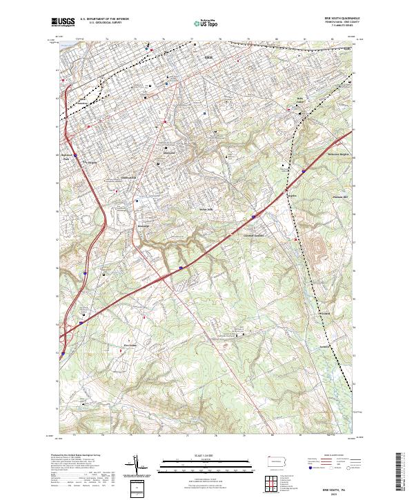
2023 Map of Erie South
USGS Topo · Published 2023About this map
Erie serves as the focal point of this landscape, with suburban expansion stretching south from the Bayfront Con through Glenwood and into the Weber Hills region. The area is marked by a dense concentration of academic and spiritual sites, ranging from Mercyhurst University to the Saint John's Lutheran Church Cem. The southern reach of the city transitions into more open terrain around Kearsarge and Belle Valley, where numerous burial grounds like the Grubb Burial Ground and Anshe Hesed Cem provide valuable touchpoints for genealogical research.
Find a feature on this map
47 named features on this map. Tap any name to fly to it.
Don’t see what you’re looking for? This feature index may not catch every label — zoom into the map to look around manually.
Map Details
Editions of this 2023 Erie South Map
This is the sole edition of this map. No revisions or reprints were ever made.
Other maps of this area

1899 · Erie
USGS Topo · 1:62,500

1900 · Erie
USGS Topo · 1:62,500

1913 · North East
USGS Topo · 1:62,500

1915 · North East
USGS Topo · 1:62,500

1923 · Cambridge Springs
USGS Topo · 1:62,500

1925 · Cambridge Springs
USGS Topo · 1:62,500

1929 · Union City
USGS Topo · 1:62,500

1932 · Union City
USGS Topo · 1:62,500

1943 · North East
USGS Topo · 1:62,500

1943 · Cambridge Springs
USGS Topo · 1:62,500