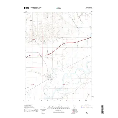
2018 Map of Erie
USGS Topo · Published 2018About this map
The Rock River meanders through the heart of Whiteside County, anchoring the landscape of this 2018 survey. The village of Erie sits at a critical junction near the riverbanks, where the nearby Lake Erie and Faden Slough suggest the low-lying, water-rich environment of this part of Illinois. North of the river, the terrain is dotted with smaller settlements like Fenton and Newton Corners, connected by a network of rural roads such as Moline Rd and Black Rd.
Find a feature on this map
75 named features on this map. Tap any name to fly to it.
Don’t see what you’re looking for? This feature index may not catch every label — zoom into the map to look around manually.
Map Details
Editions of this 2018 Erie Map
This is the sole edition of this map. No revisions or reprints were ever made.
Other maps of this area

1891 · Clinton
USGS Topo · 1:62,500

1894 · Clinton
USGS Topo · 1:62,500

1899 · Clinton
USGS Topo · 1:125,000

1932 · Prophetstown
USGS Topo · 1:48,000

1934 · Morrison
USGS Topo · 1:48,000

1936 · Prophetstown
USGS Topo · 1:62,500

1940 · Morrison
USGS Topo · 1:62,500

1952 · Erie
USGS Topo · 1:62,500

1952 · Clinton
USGS Topo · 1:62,500
1953 · Clinton
USGS Topo · 1:24,000