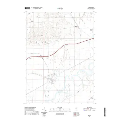
2021 Map of Erie
USGS Topo · Published 2021About this map
Rock River meanders across this Whiteside County landscape, defining the character of Erie and its surrounding agricultural terrain. The river is accompanied by complex water features including Faden Slough and Hadaway Slough, indicating a low-lying, well-watered valley floor. To the north, the terrain becomes more varied around Fenton and Newton Corners, where small creeks like Lynn Cr and Rock Creek drain toward the primary river system. This modern survey illustrates the persistent rural infrastructure of the region, anchored by established sites such as Erie Cem, Smack Cem, and Fenton Cem. Local aviation history is represented by Frank's Flying Service in the northeast, while the name Mineral Springs suggests the area's natural hydrological features.
Find a feature on this map
71 named features on this map. Tap any name to fly to it.
Don’t see what you’re looking for? This feature index may not catch every label — zoom into the map to look around manually.
Map Details
Editions of this 2021 Erie Map
This is the sole edition of this map. No revisions or reprints were ever made.
Other maps of this area

1891 · Clinton
USGS Topo · 1:62,500

1894 · Clinton
USGS Topo · 1:62,500

1899 · Clinton
USGS Topo · 1:125,000

1932 · Prophetstown
USGS Topo · 1:48,000

1934 · Morrison
USGS Topo · 1:48,000

1936 · Prophetstown
USGS Topo · 1:62,500

1940 · Morrison
USGS Topo · 1:62,500

1952 · Erie
USGS Topo · 1:62,500

1952 · Clinton
USGS Topo · 1:62,500
1953 · Clinton
USGS Topo · 1:24,000