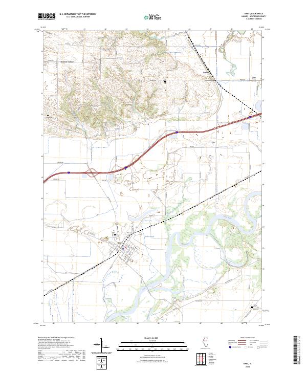
2024 Map of Erie
USGS Topo · Published 2024About this map
The Rock River dominates the southern landscape of this Whiteside County quadrangle, carving a wide path through the prairie south of Erie. The settlement of Erie sits at a significant junction of local history and modern transport, where the river's wetland features like Faden Slough and Hadway Slough define the low-lying terrain. To the north, the small community of Fenton and the crossroads at Newton Corners anchor a grid of rural roads that follow the early township lines. Genealogists will find several burial grounds across the area, including Fenton Cem, Smack Cem, and the Town Cem near the river. The presence of Frank's Flying Service in the northeast near Rock Creek highlights the local aviation history that persists alongside the traditional agricultural economy of this western Illinois river valley.
Find a feature on this map
71 named features on this map. Tap any name to fly to it.
Don’t see what you’re looking for? This feature index may not catch every label — zoom into the map to look around manually.
Map Details
Editions of this 2024 Erie Map
This is the sole edition of this map. No revisions or reprints were ever made.
Other maps of this area

1891 · Clinton
USGS Topo · 1:62,500

1894 · Clinton
USGS Topo · 1:62,500

1899 · Clinton
USGS Topo · 1:125,000

1932 · Prophetstown
USGS Topo · 1:48,000

1934 · Morrison
USGS Topo · 1:48,000

1936 · Prophetstown
USGS Topo · 1:62,500

1940 · Morrison
USGS Topo · 1:62,500

1952 · Erie
USGS Topo · 1:62,500

1952 · Clinton
USGS Topo · 1:62,500
1953 · Clinton
USGS Topo · 1:24,000