
1952 Map of Erie
USGS Topo · Published 1953About this map
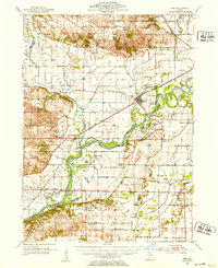
The Rock River meanders across this mid-century landscape, carving a complex network of wetlands and islands including Kempster Island and Peterson I. This 1952 topographical survey by the U.S. Geological Survey illustrates an agricultural region defined by its proximity to the river, where the Chicago Burlington and Quincy railroad connects towns like Erie and Joslin. The map documents a dense distribution of rural infrastructure, from the Old Stage Line Monument near the Rock River to numerous country schools such as Wheelock Sch and Pleasant Hill Sch.
Find a feature on this map
72 named features on this map. Tap any name to fly to it.
Don’t see what you’re looking for? This feature index may not catch every label — zoom into the map to look around manually.
Map Details
Editions of this 1952 Erie Map
2 editions found
Other maps of this area

1891 · Clinton
USGS Topo · 1:62,500

1892 · Goose Lake
USGS Topo · 1:62,500

1892 · Leclaire
USGS Topo · 1:62,500

1893 · Leclaire
USGS Topo · 1:62,500

1894 · Goose Lake
USGS Topo · 1:62,500

1894 · Clinton
USGS Topo · 1:62,500

1899 · Clinton
USGS Topo · 1:125,000

1929 · Annawan
USGS Topo · 1:62,500

1932 · Prophetstown
USGS Topo · 1:48,000

1932 · Annawan
USGS Topo · 1:62,500