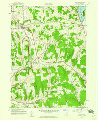
1943 Map of Erieville
USGS Topo · Published 1960About this map
Erieville and the surrounding highlands of Madison County appear in this 1943 survey, capturing the agricultural and rail character of the region during the mid-twentieth century. The Lehigh Valley railroad cuts through the western portion of the map, serving small hubs like New Woodstock and Delphi Sta. This transit corridor shaped the development of local dairy farming and commerce in the valley of Limestone Creek.
Find a feature on this map
26 named features on this map. Tap any name to fly to it.
Don’t see what you’re looking for? This feature index may not catch every label — zoom into the map to look around manually.
Map Details
Editions of this 1943 Erieville Map
2 editions found
Other maps of this area

1897 · Cazenovia
USGS Topo · 1:62,500

1899 · Cazenovia
USGS Topo · 1:62,500

1902 · Morrisville
USGS Topo · 1:62,500

1903 · Norwich
USGS Topo · 1:62,500

1904 · Pitcher
USGS Topo · 1:62,500

1942 · Oran
USGS Topo · 1:24,000
1943 · Oran
USGS Topo · 1:31,680

1943 · Otselic
USGS Topo · 1:24,000

1943 · De Ruyter
USGS Topo · 1:24,000
1943 · Cazenovia
USGS Topo · 1:24,000