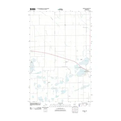
2010 Map of Erskine
USGS Topo · Published 2010About this map
Erskine anchors this northern Minnesota landscape, situated amidst a dense network of glacial lakes and managed waterways. The settlement's proximity to Cameron Lake and Badger Lake is central to the area's development, with recreation sites like Lake Cameron RV Park and Campground and Saint Michael's Park Campground serving as prominent landmarks. The survey documents the complex hydrology of the region, including Judicial Ditch Number Seventythree and numerous smaller bodies of water such as Eighteen Lake, Bee Lake, and Tamarack Lake.
Find a feature on this map
34 named features on this map. Tap any name to fly to it.
Don’t see what you’re looking for? This feature index may not catch every label — zoom into the map to look around manually.
Map Details
Editions of this 2010 Erskine Map
This is the sole edition of this map. No revisions or reprints were ever made.
Other maps of this area

1918 · Terrebonne
USGS Topo · 1:62,500

1919 · Grit
USGS Topo · 1:62,500

1919 · Valley
USGS Topo · 1:62,500

1952 · Grand Forks
USGS Topo · 1:250,000

1954 · Bemidji
USGS Topo · 1:250,000

1956 · Grand Forks
USGS Topo · 1:250,000

1957 · Bemidji
USGS Topo · 1:250,000

1958 · Bemidji
USGS Topo · 1:250,000

1964 · Terrebonne
USGS Topo · 1:24,000

1964 · Brooks
USGS Topo · 1:24,000