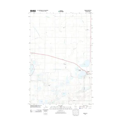
2013 Map of Erskine
USGS Topo · Published 2013About this map
Erskine serves as the primary hub in this portion of Polk County, situated at the junction of two major transit corridors, Us-2 and Us-59. The surrounding landscape is defined by an extensive network of glacial lakes and managed waterways, including Badger Lake, Cameron Lake, and the winding path of Upper Badger Cr. This survey illustrates the intricate balance between agricultural drainage and natural water bodies, as seen in the engineered channels of Judicial Ditch Number Seventythree and County Ditch Number One Hundred Eleven. For those researching local heritage, several rural cemeteries are documented across the plains, such as Sorum Cem, Saron Lutheran Cem, Broderheim Cem, and Rodnes Cem, often located near crossroads or church sites. Recreation is concentrated near the settlement at Lake Cameoon RV Park and Campground and Saint Michael's Park Campground, highlighting the area's role as a gateway to Minnesota's northern lake country.
Find a feature on this map
35 named features on this map. Tap any name to fly to it.
Don’t see what you’re looking for? This feature index may not catch every label — zoom into the map to look around manually.
Map Details
Editions of this 2013 Erskine Map
This is the sole edition of this map. No revisions or reprints were ever made.
Other maps of this area

1918 · Terrebonne
USGS Topo · 1:62,500

1919 · Grit
USGS Topo · 1:62,500

1919 · Valley
USGS Topo · 1:62,500

1952 · Grand Forks
USGS Topo · 1:250,000

1954 · Bemidji
USGS Topo · 1:250,000

1956 · Grand Forks
USGS Topo · 1:250,000

1957 · Bemidji
USGS Topo · 1:250,000

1958 · Bemidji
USGS Topo · 1:250,000

1964 · Terrebonne
USGS Topo · 1:24,000

1964 · Brooks
USGS Topo · 1:24,000