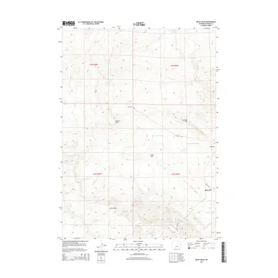
2015 Map of Ervay Basin
USGS Topo · Published 2015About this map
Ervay Basin and the surrounding high country of Natrona County characterize this corner of Wyoming, where the headwaters of the S Fork Powder River emerge from the high ridges. The landscape is defined by its drainage and livestock history, marked by vital water sources like Sulphur Spring and Collins Spring, as well as the Defelder Reservoir to the north. Settlement is sparse, with the community of Raderville situated in the east near the junction of Cow Camp Rd and W Poison Spider Rd. Historical transit and industry are visible in the naming of Butler Oil Rd, which skirts the Coalbank Hills. Prominent landmarks such as Maverick Butte and Cyclone Ridge provide a sense of the dramatic elevation changes that funnel toward Hoff Gap and the northern plains.
Find a feature on this map
20 named features on this map. Tap any name to fly to it.
Don’t see what you’re looking for? This feature index may not catch every label — zoom into the map to look around manually.
Map Details
Editions of this 2015 Ervay Basin Map
This is the sole edition of this map. No revisions or reprints were ever made.
Other maps of this area

1952 · Ervay Basin SW
USGS Topo · 1:24,000

1952 · Arminto SW
USGS Topo · 1:24,000

1952 · Gas Hills
USGS Topo · 1:24,000

1952 · Moneta SE
USGS Topo · 1:24,000

1952 · Miles Ranch
USGS Topo · 1:24,000

1952 · Hiland
USGS Topo · 1:24,000

1952 · Ervay Basin
USGS Topo · 1:24,000

1955 · Arminto
USGS Topo · 1:250,000

1955 · Casper
USGS Topo · 1:250,000

1957 · Miles Ranch
USGS Topo · 1:24,000