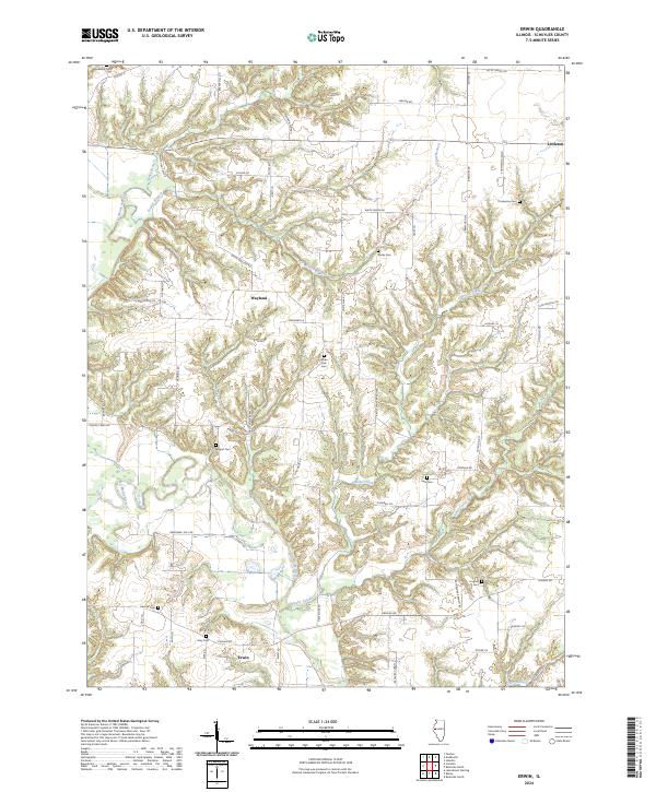
2024 Map of Erwin
USGS Topo · Published 2024About this map
Erwin and Wayland sit amidst a complex network of streams and agricultural land in Schuyler County, where the La Moine River winds through the western terrain. The landscape is defined by the deep dissection of drainage systems like Honey Branch, Fowler Branch, and Brushy Creek, which create a series of ridges and valleys that have historically dictated the placement of roads and homesteads. For genealogists, the area is particularly rich in family-named landmarks and rural burial sites. Numerous small cemeteries are scattered throughout the quadrangle, including Blackburn Cem, Neidy Cem, and Thompson Cem, many of which are accessed by specialized local routes like Thompson Cem Ln and White Oak Cem Rd. The proximity of Ayers Slough to the La Moine River highlights the low-lying wetlands that contrast with the upland prairie plots.
Find a feature on this map
63 named features on this map. Tap any name to fly to it.
Don’t see what you’re looking for? This feature index may not catch every label — zoom into the map to look around manually.
Map Details
Editions of this 2024 Erwin Map
This is the sole edition of this map. No revisions or reprints were ever made.
Other maps of this area

1912 · Macomb
USGS Topo · 1:62,500

1913 · Colchester
USGS Topo · 1:62,500

1914 · Macomb
USGS Topo · 1:62,500

1923 · Rushville
USGS Topo · 1:62,500

1926 · Rushville
USGS Topo · 1:62,500

1946 · Augusta
USGS Topo · 1:62,500

1949 · Augusta
USGS Topo · 1:62,500

1958 · Burlington
USGS Topo · 1:250,000

1961 · Burlington
USGS Topo · 1:250,000

1963 · Burlington
USGS Topo · 1:250,000