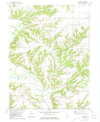
1981 Map of Erwin
USGS Topo · Published 1981About this map
The La Moine River winds through the southwestern reaches of this Schuyler County landscape, defining the boundaries between the townships of Brooklyn, Littleton, Camden, and Buena Vista. Small agricultural settlements like Wayland and Erwin serve as anchors for the surrounding rural territory, which is heavily dissected by numerous watercourses including Brushy Creek, Stony Creek, and Horney Branch.
Find a feature on this map
28 named features on this map. Tap any name to fly to it.
Don’t see what you’re looking for? This feature index may not catch every label — zoom into the map to look around manually.
Map Details
Editions of this 1981 Erwin Map
This is the sole edition of this map. No revisions or reprints were ever made.
Other maps of this area

1912 · Macomb
USGS Topo · 1:62,500

1913 · Colchester
USGS Topo · 1:62,500

1914 · Macomb
USGS Topo · 1:62,500

1923 · Rushville
USGS Topo · 1:62,500

1926 · Rushville
USGS Topo · 1:62,500

1946 · Augusta
USGS Topo · 1:62,500

1949 · Augusta
USGS Topo · 1:62,500

1958 · Burlington
USGS Topo · 1:250,000

1961 · Burlington
USGS Topo · 1:250,000

1963 · Burlington
USGS Topo · 1:250,000