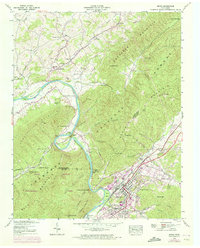
1939 Map of Erwin
USGS Topo · Published 1972About this map
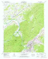
The Nolichucky River carves a dramatic path through this 1939 landscape, defining the transition between the valley floor and the heights of Buffalo Mountain. At the heart of the region, Erwin serves as a critical junction for the Clinchfield railroad, featuring extensive rail yards and supporting communities like Banner Hill and Lillydale. The map documents a blend of industrial activity and rural persistence, with a Gaging Station and Fish Hatchery situated near the water, while upland areas like Bumpus Cove reveal a network of older settlements and burial grounds including Bumpus Cove Cem.
Find a feature on this map
75 named features on this map. Tap any name to fly to it.
Don’t see what you’re looking for? This feature index may not catch every label — zoom into the map to look around manually.
Map Details
Editions of this 1939 Erwin Map
5 editions found
Other maps of this area

1891 · Roan Mountain
USGS Topo · 1:125,000

1892 · Greeneville
USGS Topo · 1:125,000

1894 · Roan Mountain
USGS Topo · 1:125,000

1896 · Greeneville
USGS Topo · 1:125,000

1904 · Roan Mountain
USGS Topo · 1:125,000

1904 · Greeneville
USGS Topo · 1:125,000

1935 · Chestoa
USGS Topo · 1:24,000

1935 · Leesburg
USGS Topo · 1:24,000

1935 · Erwin
USGS Topo · 1:24,000

1935 · Huntdale
USGS Topo · 1:24,000