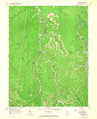
1965 Map of Eskdale
USGS Topo · Published 1966About this map
Cabin Creek serves as the industrial spine for this region of West Virginia, where a dense network of coal-related infrastructure follows the narrow valley floors. The Chesapeake and Ohio railroad line parallels the creek, supporting a string of company towns and rail facilities including Cane Fork Yards, Leewood, and Eskdale. These settlements are tightly packed between the steep ridges of the Boone and Kanawha County line, reflecting the era's dependence on the valley floor for transport and housing.
Find a feature on this map
62 named features on this map. Tap any name to fly to it.
Don’t see what you’re looking for? This feature index may not catch every label — zoom into the map to look around manually.
Map Details
Editions of this 1965 Eskdale Map
2 editions found
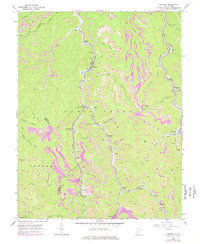
Other maps of this area

1891 · Oceana
USGS Topo · 1:125,000

1891 · Raleigh
USGS Topo · 1:125,000

1893 · Oceana
USGS Topo · 1:125,000

1897 · Kanawha Falls
USGS Topo · 1:125,000

1897 · Raleigh
USGS Topo · 1:125,000

1898 · Oceana
USGS Topo · 1:125,000

1899 · Charleston
USGS Topo · 1:125,000

1900 · Kanawha Falls
USGS Topo · 1:125,000

1901 · Kanawha Falls
USGS Topo · 1:125,000

1902 · Raleigh
USGS Topo · 1:125,000