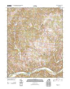
2013 Map of Esmont
USGS Topo · Published 2013About this map
The James River forms the southern boundary of this Piedmont landscape, defining a region where historic agriculture and river transport once dictated the pace of life. Near the southern bank, Hattons Ferry remains a rare touchpoint for traditional river crossings, while the village of Hatton and nearby Hatton Grange Farm reflect the deep-rooted agricultural heritage of the area. Moving inland, the terrain is marked by Green Mountain and the Totier Hills, providing a backdrop for established estates and named rural tracts like Nydrie Farms and Old Woodville.
Find a feature on this map
100 named features on this map. Tap any name to fly to it.
Don’t see what you’re looking for? This feature index may not catch every label — zoom into the map to look around manually.
Map Details
Editions of this 2013 Esmont Map
This is the sole edition of this map. No revisions or reprints were ever made.
Other maps of this area

1891 · Palmyra
USGS Topo · 1:125,000

1892 · Buckingham
USGS Topo · 1:125,000

1895 · Palmyra
USGS Topo · 1:125,000

1897 · Palmyra
USGS Topo · 1:125,000

1929 · Covesville
USGS Topo · 1:62,500

1935 · Covesville
USGS Topo · 1:62,500

1943 · Scottsville
USGS Topo · 1:62,500

1945 · Covesville
USGS Topo · 1:62,500

1946 · Scottsville
USGS Topo · 1:62,500

1947 · Roanoke
USGS Topo · 1:250,000