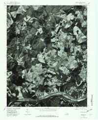
1979 Map of Esmont
USGS Topo · Published 1982About this map
Esmont and the surrounding Albemarle County countryside are revealed in this 1979 orthophotoquad, which uses aerial imagery to document the Piedmont landscape. The southern boundary is defined by the James River, where the small riverside settlement of Warren sits along the bend. Moving north from the river, the land transitions into a mosaic of dense woodlands and geometric agricultural clearings, interconnected by a network of rural roads. Smaller communities such as Porters and Keene serve as local hubs for this farming region.
Find a feature on this map
11 named features on this map. Tap any name to fly to it.
Don’t see what you’re looking for? This feature index may not catch every label — zoom into the map to look around manually.
Map Details
Editions of this 1979 Esmont Map
This is the sole edition of this map. No revisions or reprints were ever made.
Other maps of this area

1891 · Palmyra
USGS Topo · 1:125,000

1892 · Buckingham
USGS Topo · 1:125,000

1895 · Palmyra
USGS Topo · 1:125,000

1897 · Palmyra
USGS Topo · 1:125,000

1929 · Covesville
USGS Topo · 1:62,500

1935 · Covesville
USGS Topo · 1:62,500

1943 · Scottsville
USGS Topo · 1:62,500

1945 · Covesville
USGS Topo · 1:62,500

1946 · Scottsville
USGS Topo · 1:62,500

1947 · Roanoke
USGS Topo · 1:250,000