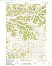
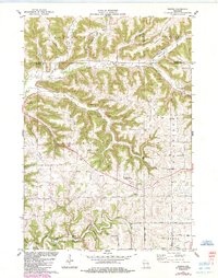
1983 Map of Esofea
USGS Topo · Published 1983About this map
The Driftless Area of Vernon County is defined by its dendritic ridge-and-valley topography, where small rural communities like Coon Valley and Esofea follow the narrow floors of deep coulees. In this landscape, agricultural settlement patterns are dictated by the terrain, with roads tracing the narrow tops of features like Ridge Road or following the winding path of Coon Creek. Evidence of early community life is found at the numerous rural houses of worship, including Skogdalen Ch, Bethany Ch, and Vang Ch, which served dispersed farming families.
Find a feature on this map
50 named features on this map. Tap any name to fly to it.
Don’t see what you’re looking for? This feature index may not catch every label — zoom into the map to look around manually.
Map Details
Editions of this 1983 Esofea Map
2 editions found
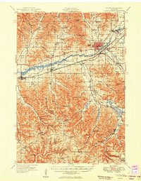
Other maps of this area

1909 · Sparta
USGS Topo · 1:62,500

1923 · Viroqua
USGS Topo · 1:62,500

1926 · Stoddard
USGS Topo · 1:62,500

1926 · Viroqua
USGS Topo · 1:62,500

1927 · La Crosse
USGS Topo · 1:62,500

1930 · La Crosse
USGS Topo · 1:62,500

1947 · Sparta
USGS Topo · 1:62,500
1949 · Sparta
USGS Topo · 1:62,500

1958 · La Crosse
USGS Topo · 1:250,000

1961 · La Crosse
USGS Topo · 1:250,000