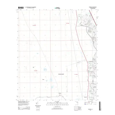
2015 Map of Espanola
USGS Topo · Published 2015About this map
Espanola and the small settlement of Neoga sit at the center of this landscape during a period of significant residential expansion in Flagler County. The map reveals the contrast between the historic rural layout and the emerging planned street networks of Palm Coast, where dense residential corridors like Londonderry Dr and Louisiana Dr press against the undeveloped wetlands and pine flatwoods. To the west, the terrain remains defined by natural features such as Honey Hill and a series of water bodies including Speckled Perch Lake, Neoga Lake, and Black Lake. Long-standing infrastructure is visible through Hargrove Grade and CR-13, which provide access to the Espanola Cem. The southeastern corner shows the northern reaches of Bunnell, while the Saint Joe Canal serves as a major hydrological marker amidst the growing suburban development.
Find a feature on this map
112 named features on this map. Tap any name to fly to it.
Don’t see what you’re looking for? This feature index may not catch every label — zoom into the map to look around manually.
Map Details
Editions of this 2015 Espanola Map
This is the sole edition of this map. No revisions or reprints were ever made.
Other maps of this area

1927 · Matanzas
USGS Topo · 1:48,000

1937 · Dinner Island
USGS Topo · 1:48,000

1937 · Ormond
USGS Topo · 1:48,000

1943 · Dinner Island
USGS Topo · 1:62,500

1943 · Matanzas
USGS Topo · 1:62,500

1944 · Ormond
USGS Topo · 1:62,500

1944 · Dinner Island
USGS Topo · 1:62,500

1944 · Matanzas
USGS Topo · 1:62,500

1954 · Daytona Beach
USGS Topo · 1:250,000

1956 · Dinner Island NE
USGS Topo · 1:24,000