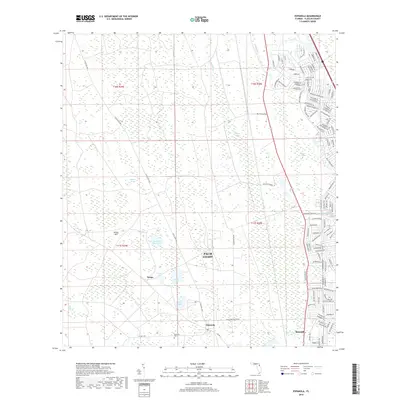
2018 Map of Espanola
USGS Topo · Published 2018About this map
Palm Coast and the surrounding Flagler County landscape are shown here as the suburban expansion of the early 21st century meets the historic marshlands of the Florida interior. The map documents a distinct transition between the modern residential street grids developing near the Saint Joe Canal and the older, more rural settlements of Espanola and Bunnell. In the western portion of the quadrangle, the terrain is dominated by the vast Big Cypress Swamp and Pringle Swamp, where the landscape remains largely undeveloped except for drainage features like Pringle Br. For those tracing local history or genealogy, the Espanola Cem stands near the crossroads of Co Rd 13. The area's hydrology is marked by numerous small bodies of water, including Speckled Perch Lake and Neoga Lake, illustrating the complex water table of this low-lying region.
Find a feature on this map
117 named features on this map. Tap any name to fly to it.
Don’t see what you’re looking for? This feature index may not catch every label — zoom into the map to look around manually.
Map Details
Editions of this 2018 Espanola Map
This is the sole edition of this map. No revisions or reprints were ever made.
Other maps of this area

1927 · Matanzas
USGS Topo · 1:48,000

1937 · Dinner Island
USGS Topo · 1:48,000

1937 · Ormond
USGS Topo · 1:48,000

1943 · Dinner Island
USGS Topo · 1:62,500

1943 · Matanzas
USGS Topo · 1:62,500

1944 · Ormond
USGS Topo · 1:62,500

1944 · Dinner Island
USGS Topo · 1:62,500

1944 · Matanzas
USGS Topo · 1:62,500

1954 · Daytona Beach
USGS Topo · 1:250,000

1956 · Dinner Island NE
USGS Topo · 1:24,000