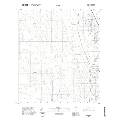
2021 Map of Espanola
USGS Topo · Published 2021About this map
Palm Coast and the surrounding Flagler County pinelands are captured in this 2021 survey, illustrating the juxtaposition of modern residential expansion and the historic wetlands of northeast Florida. The map shows the grid-like residential developments of Palm Coast pushing westward toward established natural features like Pringle Swamp and Hulett Swamp. To the south, the settlement of Espanola remains centered near Espanola Cem, connected by the historic route of N Old Dixie Hwy. This corridor traces the older agricultural and transit backbone of the region, where the terrain transitions into the Big Cypress Swamp. The presence of Neoga and localized water bodies such as Speckled Perch Lake and Neoga Lake highlight the low-lying hydrology that has long defined local land use and settlement patterns.
Find a feature on this map
104 named features on this map. Tap any name to fly to it.
Don’t see what you’re looking for? This feature index may not catch every label — zoom into the map to look around manually.
Map Details
Editions of this 2021 Espanola Map
This is the sole edition of this map. No revisions or reprints were ever made.
Other maps of this area

1927 · Matanzas
USGS Topo · 1:48,000

1937 · Dinner Island
USGS Topo · 1:48,000

1937 · Ormond
USGS Topo · 1:48,000

1943 · Dinner Island
USGS Topo · 1:62,500

1943 · Matanzas
USGS Topo · 1:62,500

1944 · Ormond
USGS Topo · 1:62,500

1944 · Dinner Island
USGS Topo · 1:62,500

1944 · Matanzas
USGS Topo · 1:62,500

1954 · Daytona Beach
USGS Topo · 1:250,000

1956 · Dinner Island NE
USGS Topo · 1:24,000