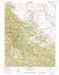
1949 Map of Espinosa Canyon
USGS Topo · Published 1979About this map
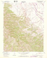
The Salinas River flows through this portion of Monterey County, defining the eastern edge of a landscape deeply carved by numerous drainages. These canyons, many bearing family names like Robinson Canyon, Davis Canyon, and Loridon Canyon, suggest a history of localized ranching and homesteading in the mid-20th century. The intricate network of seasonal waterways, including Feliz Canyon and Broadhurst Canyon, feeds into the larger river valley from the surrounding hills.
Find a feature on this map
22 named features on this map. Tap any name to fly to it.
Don’t see what you’re looking for? This feature index may not catch every label — zoom into the map to look around manually.
Map Details
Editions of this 1949 Espinosa Canyon Map
6 editions found
Other maps of this area

1912 · San Ardo
USGS Topo · 1:31,680

1915 · Priest Valley
USGS Topo · 1:125,000

1919 · King City
USGS Topo · 1:62,500

1919 · Bryson
USGS Topo · 1:62,500

1919 · Bradley
USGS Topo · 1:62,500

1939 · King City
USGS Topo · 1:62,500

1941 · San Ardo
USGS Topo · 1:62,500

1941 · Bradley
USGS Topo · 1:62,500

1941 · Bryson
USGS Topo · 1:62,500

1942 · Bryson
USGS Topo · 1:62,500