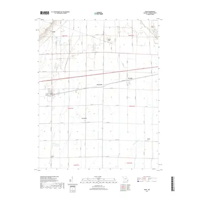
2017 Map of Essex
USGS Topo · Published 2017About this map
Essex stands as the primary hub in this corner of Stoddard County, where a grid of local roads and the Union Pacific railroad corridor dictate the movement of goods and people. The landscape is defined by the drainage patterns of the Missouri Bootheel, evidenced by the channel of Bess Slough and the engineered precision of Lateral Number 4. Small, established communities like Grayridge, Hunterville, and Circle City are dispersed across the plains, often situated along key transportation arteries like State Hwy E or State Hwy N. In the southern reaches, the settlement of Frisco and the meandering Upper Castor River provide further orientation for those studying the area's agricultural geography. The map reveals a highly structured rural environment where section lines and county roads, such as Co Rd 712 and Co Rd 554, form a geometric framework for the surrounding farmland.
Find a feature on this map
68 named features on this map. Tap any name to fly to it.
Don’t see what you’re looking for? This feature index may not catch every label — zoom into the map to look around manually.
Map Details
Editions of this 2017 Essex Map
This is the sole edition of this map. No revisions or reprints were ever made.
Other maps of this area

1931 · Sikeston
USGS Topo · 1:62,500

1934 · Bloomfield
USGS Topo · 1:62,500

1934 · Sikeston
USGS Topo · 1:62,500

1939 · Bloomfield
USGS Topo · 1:62,500

1939 · Sikeston
USGS Topo · 1:62,500

1939 · New Madrid
USGS Topo · 1:62,500

1940 · Malden
USGS Topo · 1:62,500

1949 · Bloomfield
USGS Topo · 1:62,500

1954 · New Madrid
USGS Topo · 1:62,500

1956 · Malden
USGS Topo · 1:62,500