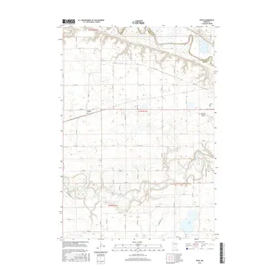
2016 Map of Essig
USGS Topo · Published 2016About this map
The Cottonwood River carves a winding path across this landscape, defining the rural character of Brown County. Near the western edge, the small settlement of Essig sits along the corridor of Co Hwy 14, serving as a primary point of reference for researchers tracing local development in this agricultural region. The northeastern corner is shaped by the wide bends of the Minnesota River and the Brown Co Nicollet Co boundary line, where the topography shifts from flat farmland into steep river bluffs.
Find a feature on this map
48 named features on this map. Tap any name to fly to it.
Don’t see what you’re looking for? This feature index may not catch every label — zoom into the map to look around manually.
Map Details
Editions of this 2016 Essig Map
This is the sole edition of this map. No revisions or reprints were ever made.
Other maps of this area

1953 · New Ulm
USGS Topo · 1:250,000

1957 · New Ulm
USGS Topo · 1:250,000

1958 · New Ulm
USGS Topo · 1:250,000

1964 · New Ulm
USGS Topo · 1:24,000

1964 · Sleepy Eye NW
USGS Topo · 1:24,000

1964 · Sleepy Eye
USGS Topo · 1:24,000

1964 · Essig
USGS Topo · 1:24,000

1964 · Lafayette
USGS Topo · 1:24,000

1964 · St George
USGS Topo · 1:24,000

1965 · Hanska
USGS Topo · 1:24,000