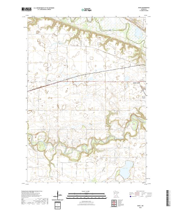
2022 Map of Essig
USGS Topo · Published 2022About this map
Essig sits at the heart of this agricultural landscape in Brown County, defined by a meticulously surveyed grid of township roads and county highways. The drainage of the prairie is evident in the engineered County Ditch Number Fifty-one, which channels water through the northern fields toward the Minnesota River. In the southeast, the terrain softens as the Cottonwood River meanders toward the edge of New Ulm, creating a riparian corridor followed by the Cottonwood River Trl. This modern survey illustrates the transition from the concentrated settlement at the New Ulm Municipal Airport to the expansive farmsteads that define the region. Notable water features like Clear Lake and the various river bends provide contrast to the productive land, while the boundary with Nicollet County is marked along the northern river bluffs.
Find a feature on this map
50 named features on this map. Tap any name to fly to it.
Don’t see what you’re looking for? This feature index may not catch every label — zoom into the map to look around manually.
Map Details
Editions of this 2022 Essig Map
This is the sole edition of this map. No revisions or reprints were ever made.
Other maps of this area

1953 · New Ulm
USGS Topo · 1:250,000

1957 · New Ulm
USGS Topo · 1:250,000

1958 · New Ulm
USGS Topo · 1:250,000

1964 · New Ulm
USGS Topo · 1:24,000

1964 · Sleepy Eye NW
USGS Topo · 1:24,000

1964 · Sleepy Eye
USGS Topo · 1:24,000

1964 · Essig
USGS Topo · 1:24,000

1964 · Lafayette
USGS Topo · 1:24,000

1964 · St George
USGS Topo · 1:24,000

1965 · Hanska
USGS Topo · 1:24,000