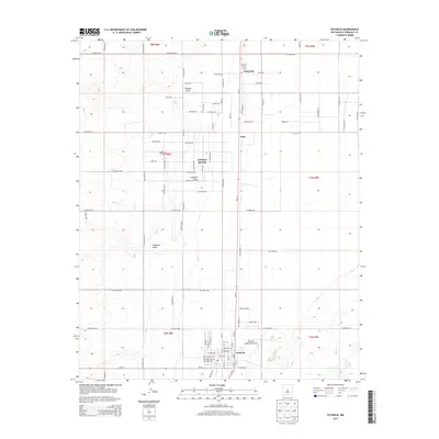
2013 Map of Estancia
USGS Topo · Published 2013About this map
Estancia serves as the focal point of this Torrance County landscape, situated at the junction of several critical regional corridors. The map details the town's grid and its proximity to Estancia Spring and the Estancia Municipal Airport. To the north, the small settlements of Witt and Mcintosh line the highway, with the latter featuring the Mcintosh Cem. This portion of the Estancia Valley is defined by its drainage patterns, notably Cienega Draw, Compton Draw, and Milbourn Draw, which reveal the hydrological character of this high-elevation basin. The surrounding territory is marked by a dense network of county roads, such as Co Road AG72 and Iceplant Rd, which facilitate movement between scattered homesteads and the central hub at Estancia. Natural water sources like Antelope Springs remain significant landmarks in this arid environment.
Find a feature on this map
58 named features on this map. Tap any name to fly to it.
Don’t see what you’re looking for? This feature index may not catch every label — zoom into the map to look around manually.
Map Details
Editions of this 2013 Estancia Map
This is the sole edition of this map. No revisions or reprints were ever made.
Other maps of this area

1917 · Estancia
USGS Topo · 1:125,000

1954 · Chilili
USGS Topo · 1:24,000

1954 · Milbourn Ranch
USGS Topo · 1:24,000

1954 · Fort Sumner
USGS Topo · 1:250,000

1954 · Socorro
USGS Topo · 1:250,000

1956 · Estancia
USGS Topo · 1:62,500

1956 · Mountainair
USGS Topo · 1:62,500

1958 · Socorro
USGS Topo · 1:250,000

1958 · Fort Sumner
USGS Topo · 1:250,000

1960 · Lobo Hill
USGS Topo · 1:62,500