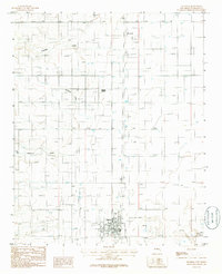
1986 Map of Estancia
USGS Topo · Published 1986About this map
Estancia serves as the primary hub of this 1980s Torrance County landscape, showing a grid of streets and civic features like the City Park and Athletic Field. The surrounding Estancia Valley reveals a complex water-management history, marked by numerous Wells and drainage features such as Milbourn Draw and Arroyo Chinchonte. The presence of a Railroad Grade running north-south through Mc Intosh and past Compton points to the area's historical reliance on rail for transporting agricultural or mineral goods. To the southeast, the terrain shifts toward more arid features like Dry Lake and a Salt Flat, contrasted by the localized water source at Antelope Springs. This provisional survey preserves the precise locations of rural infrastructure, including a local Landing Strip and a Substation, reflecting the transition of this high-desert basin into a modern ranching and residential community.
Find a feature on this map
23 named features on this map. Tap any name to fly to it.
Don’t see what you’re looking for? This feature index may not catch every label — zoom into the map to look around manually.
Map Details
Editions of this 1986 Estancia Map
This is the sole edition of this map. No revisions or reprints were ever made.
Other maps of this area

1917 · Estancia
USGS Topo · 1:125,000

1954 · Chilili
USGS Topo · 1:24,000

1954 · Milbourn Ranch
USGS Topo · 1:24,000

1954 · Fort Sumner
USGS Topo · 1:250,000

1954 · Socorro
USGS Topo · 1:250,000

1956 · Estancia
USGS Topo · 1:62,500

1956 · Mountainair
USGS Topo · 1:62,500

1958 · Socorro
USGS Topo · 1:250,000

1958 · Fort Sumner
USGS Topo · 1:250,000

1960 · Lobo Hill
USGS Topo · 1:62,500