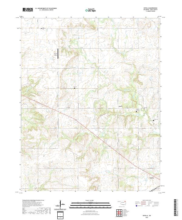
2022 Map of Estella
USGS Topo · Published 2022About this map
Estella sits at the center of this rural Oklahoma landscape, where the prairie begins to break into the drainage systems of the Neosho River basin. The area is defined by a dense network of family and community burial grounds, including the Saint Augustine Cem and Timpson Chapel Cem, which anchor the local genealogical record alongside the Scott Cem, Deal Cem, and Longtail Cem. These sites are linked by a rigid grid of section-line roads like S 4320 RD and E 230 RD, illustrating the enduring influence of the Public Land Survey System on the region's development.
Find a feature on this map
40 named features on this map. Tap any name to fly to it.
Don’t see what you’re looking for? This feature index may not catch every label — zoom into the map to look around manually.
Map Details
Editions of this 2022 Estella Map
This is the sole edition of this map. No revisions or reprints were ever made.
Other maps of this area

1901 · Vinita
USGS Topo · 1:125,000

1913 · Vinita
USGS Topo · 1:125,000

1954 · Tulsa
USGS Topo · 1:250,000

1958 · Tulsa
USGS Topo · 1:250,000

1963 · Tulsa
USGS Topo · 1:250,000

1970 · Chelsea
USGS Topo · 1:24,000

1970 · White Oak
USGS Topo · 1:24,000
1971 · Pyramid Corners
USGS Topo · 1:24,000
1971 · Big Cabin
USGS Topo · 1:24,000
1971 · Vinita
USGS Topo · 1:24,000