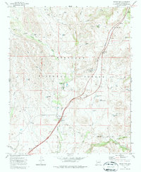
1974 Map of Estler Peak
USGS Topo · Published 1987About this map
Quarter Circle V Bar Ranch and the Orme Ranch Airstrip anchor the central valley of this Yavapai County landscape, illustrating the mid-century intersection of traditional Arizona ranching and modern aviation. Most of the territory falls within the Prescott National Forest, where the terrain rises toward the namesake summit of Estler Peak and the high ground of Honse Mesa Tank.
Find a feature on this map
44 named features on this map. Tap any name to fly to it.
Don’t see what you’re looking for? This feature index may not catch every label — zoom into the map to look around manually.
Map Details
Editions of this 1974 Estler Peak Map
2 editions found
Other maps of this area

1887 · Verde
USGS Topo · 1:250,000

1887 · Prescott
USGS Topo · 1:250,000

1892 · Verde
USGS Topo · 1:250,000

1892 · Prescott
USGS Topo · 1:250,000

1903 · Bradshaw Mountains
USGS Topo · 1:125,000

1905 · Jerome
USGS Topo · 1:125,000

1923 · Camp Verde
USGS Topo · 1:125,000

1929 · Turret Peak
USGS Topo · 1:125,000

1932 · Camp Verde
USGS Topo · 1:125,000

1933 · Turret Peak
USGS Topo · 1:125,000