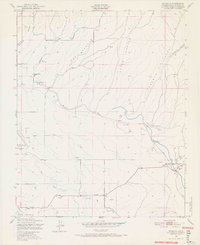
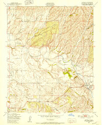
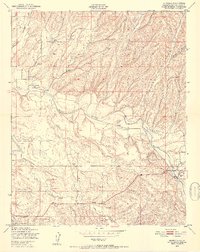
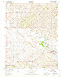
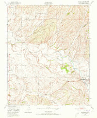
1948 Map of Estrella
USGS Topo · Published 1966About this map
Estrella River and its complex network of tributaries define this landscape in the late 1940s, where seasonal waterways like Huerhuero Creek and Dry Creek cut through a series of prominent canyons. The land use here reflects a transition between mid-century ranching and emerging infrastructure, evidenced by the presence of the Paso Robles-San Luis Obispo County Airport and a nearby Airstrip. Rural life is anchored by small community centers and educational landmarks such as Pleasant Valley Sch, Union Sch, and Phillips Sch. A network of windmills across Hog Canyon and Keyes Canyon reveals the era's reliance on groundwater for agriculture and livestock. Settlement is concentrated at Whitley Gardens and Estrella, with evidence of early energy exploration indicated by an Oil well near the southern border.
Find a feature on this map
25 named features on this map. Tap any name to fly to it.
Don’t see what you’re looking for? This feature index may not catch every label — zoom into the map to look around manually.
Map Details
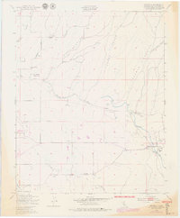
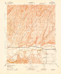
Editions of this 1948 Estrella Map
7 editions found

Other maps of this area

1914 · Cholame
USGS Topo · 1:125,000

1915 · Cholame
USGS Topo · 1:125,000

1917 · Cholame
USGS Topo · 1:125,000

1919 · San Miguel
USGS Topo · 1:62,500

1919 · Paso Robles
USGS Topo · 1:62,500
1943 · Shandon
USGS Topo · 1:31,680

1943 · Paso Robles
USGS Topo · 1:62,500

1943 · Shedd Canyon
USGS Topo · 1:31,680

1943 · Cholame Hills
USGS Topo · 1:31,680

1947 · San Luis Obispo
USGS Topo · 1:250,000