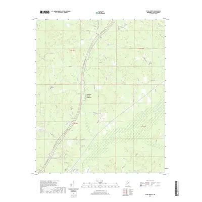
2018 Map of Ethel North
USGS Topo · Published 2018About this map
The town of Ethel anchors the southern portion of this landscape, situated near the confluence of local watercourses and early road networks. The northern reaches of the quadrangle are defined by a series of small family and community burial grounds, including the Liberty Hill Cemetery and White Plains Cemetery, suggesting a long-established pattern of rural settlement. The geography is deeply influenced by the Yockanookany River and its various tributaries such as Panther Creek and Zilpha Creek, which create a complex drainage system across the Attala County terrain. The Natchez Trace Parkway bisects the area, providing a modern transportation spine through territory once defined by local thoroughfares like Rock Port Road and Stonewall Road. Numerous churches and cemeteries, such as Mount Zion Cemetery and Pilgrim Cemetery, serve as points of interest for genealogists tracing local lineage.
Find a feature on this map
67 named features on this map. Tap any name to fly to it.
Don’t see what you’re looking for? This feature index may not catch every label — zoom into the map to look around manually.
Map Details
Editions of this 2018 Ethel North Map
This is the sole edition of this map. No revisions or reprints were ever made.
Other maps of this area

1953 · West Point
USGS Topo · 1:250,000

1958 · West Point
USGS Topo · 1:250,000

1963 · West Point
USGS Topo · 1:250,000

1964 · Kosciusko NE
USGS Topo · 1:24,000

1964 · Kosciusko
USGS Topo · 1:24,000

1966 · Poplar Creek
USGS Topo · 1:24,000

1966 · Kosciusko
USGS Topo · 1:62,500

1966 · Weir
USGS Topo · 1:24,000

1966 · French Camp
USGS Topo · 1:24,000

1968 · Weir
USGS Topo · 1:62,500