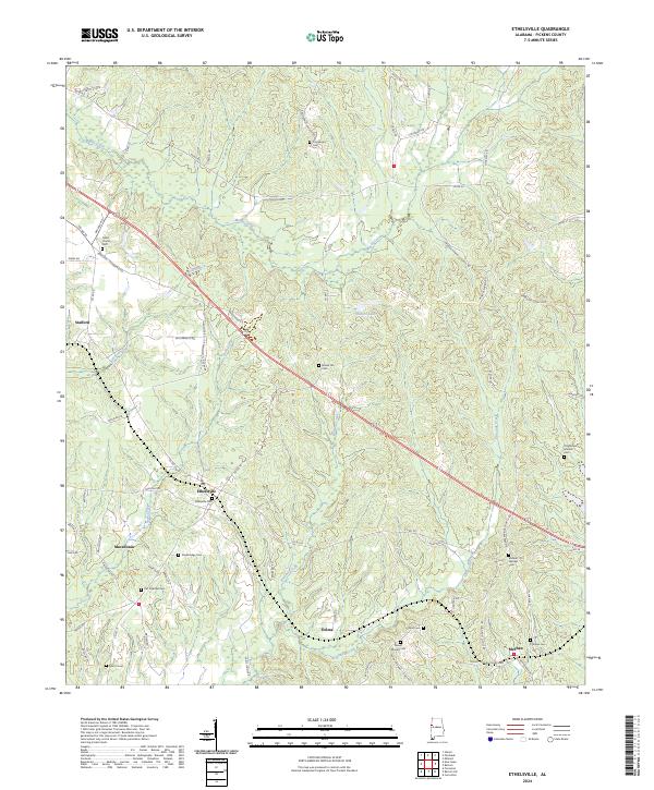
2024 Map of Ethelsville
USGS Topo · Published 2024About this map
Ethelsville and its surrounding rural communities are depicted in this Pickens County study, showing a landscape defined by small clusters of settlement and an extensive network of family-named cemeteries. The terrain is characterized by the drainages of Magby Creek and Kincaide Creek, with the town of McShan situated near the southeastern boundary. This area of West Alabama maintains its historical agricultural and timber-land character, with numerous burial grounds like Ethelsville Cem, Strawbridge Cem, and Old Mount Moriah Cem providing critical data points for genealogical research. Small settlements such as Stafford and Macedonia are connected by a web of local routes including Macedonia Rd and Yorkville Rd. The presence of Shelton Lake and Betty's Cove highlights the local water features that shaped the development of these communities.
Find a feature on this map
73 named features on this map. Tap any name to fly to it.
Don’t see what you’re looking for? This feature index may not catch every label — zoom into the map to look around manually.
Map Details
Editions of this 2024 Ethelsville Map
This is the sole edition of this map. No revisions or reprints were ever made.
Other maps of this area

1953 · West Point
USGS Topo · 1:250,000

1958 · West Point
USGS Topo · 1:250,000

1960 · Caledonia
USGS Topo · 1:62,500

1960 · Columbus
USGS Topo · 1:62,500

1963 · West Point
USGS Topo · 1:250,000

1966 · Ethelsville
USGS Topo · 1:24,000

1966 · Reform SW
USGS Topo · 1:24,000

1967 · Carrollton
USGS Topo · 1:24,000

1967 · Millport
USGS Topo · 1:24,000
1967 · Reform
USGS Topo · 1:24,000