
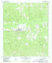
1967 Map of Millport
USGS Topo · Published 1968About this map
Millport serves as the central hub of this late 1960s survey, situated where the Southern railroad corridor meets the broad valley of Luxapallila Creek. The landscape is a network of small family and community landmarks, evidenced by the high density of burial grounds and rural congregations such as Oddfellows Cem, Eatman Cem, and Macedonia Ch. The map captures the area just as the industrial profile of the county was being marked by numerous scattered extraction sites, including a Claypit and several Gravel Pit operations.
Find a feature on this map
39 named features on this map. Tap any name to fly to it.
Don’t see what you’re looking for? This feature index may not catch every label — zoom into the map to look around manually.
Map Details
Editions of this 1967 Millport Map
2 editions found
Other maps of this area

1953 · Birmingham
USGS Topo · 1:250,000

1953 · West Point
USGS Topo · 1:250,000

1956 · Birmingham
USGS Topo · 1:250,000

1957 · Birmingham
USGS Topo · 1:250,000

1958 · West Point
USGS Topo · 1:250,000

1963 · West Point
USGS Topo · 1:250,000

1966 · Ethelsville
USGS Topo · 1:24,000

1967 · Hightogy
USGS Topo · 1:24,000

1967 · Kennedy
USGS Topo · 1:24,000
1967 · Palmetto
USGS Topo · 1:24,000