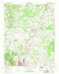
1966 Map of Ethridge
USGS Topo · Published 1969About this map
The Louisville and Nashville railroad serves as the primary industrial corridor for this region of Middle Tennessee, connecting Ethridge and the northern outskirts of Lawrenceburg. This 1960s survey illustrates a landscape transitioning from rural agricultural tracts to early suburban development, evidenced by the clustered residential blocks of Meadowview and the infrastructure surrounding the Lawrenceburg Sanitarium and Hospital. Notable for local genealogists, the map preserves the locations of several small family or community burial grounds, including Lay Cem, Yoder Cem, and Kidd Cem, many of which are tucked away near drainage features like Little Shoal Creek. Further cultural landmarks of the era include the Lawrenceburg Speedway and Dragstrip and the Radio tower (WDXE), alongside community anchors such as Shady Grove Ch and Union Hill Ch. The topography is defined by the headwaters of the Buffalo River and various hollows, including Fourmile Hollow, which shape the local road network.
Find a feature on this map
79 named features on this map. Tap any name to fly to it.
Don’t see what you’re looking for? This feature index may not catch every label — zoom into the map to look around manually.
Map Details
Editions of this 1966 Ethridge Map
2 editions found
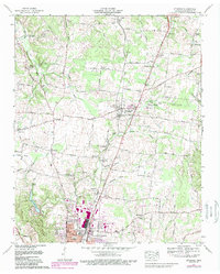
Other maps of this area

1936 · Sandy Hook
USGS Topo · 1:24,000

1936 · Deerfield
USGS Topo · 1:24,000

1936 · Henryville
USGS Topo · 1:24,000

1936 · Campbellsville
USGS Topo · 1:24,000

1936 · Lawrenceburg
USGS Topo · 1:24,000

1936 · Ethridge
USGS Topo · 1:24,000

1936 · Long Branch
USGS Topo · 1:24,000

1936 · Crestview
USGS Topo · 1:24,000

1936 · Bodenham
USGS Topo · 1:24,000

1948 · Bodenham
USGS Topo · 1:24,000