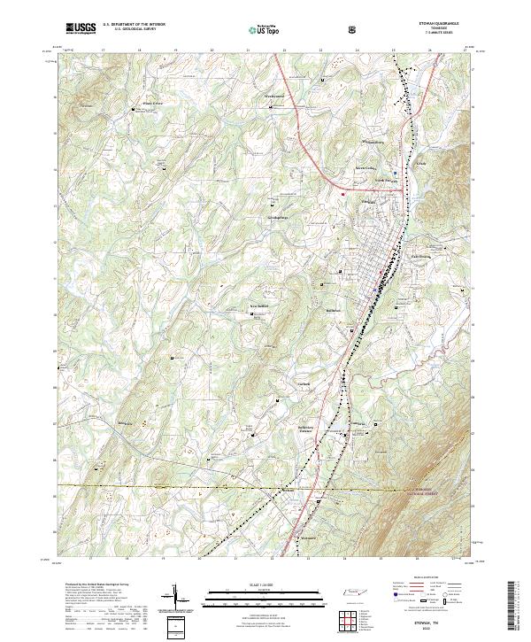
2022 Map of Etowah
USGS Topo · Published 2022About this map
The town of Etowah stands at the eastern edge of the Tennessee Valley, where the grid of city streets gives way to the rising slopes of Starr Mtn and Poplar Springs Ridge. This landscape is defined by the proximity of the Cherokee National Forest and the industrial imprint of the L and N Reservoir. The map reveals a dense network of early community centers, including Piney Grove United Methodist Church Cem, New Bethel, and Carlock.
Find a feature on this map
175 named features on this map. Tap any name to fly to it.
Don’t see what you’re looking for? This feature index may not catch every label — zoom into the map to look around manually.
Map Details
Editions of this 2022 Etowah Map
This is the sole edition of this map. No revisions or reprints were ever made.
Other maps of this area

1886 · Cleveland
USGS Topo · 1:125,000

1892 · Cleveland
USGS Topo · 1:125,000

1893 · Murphy
USGS Topo · 1:125,000

1895 · Cleveland
USGS Topo · 1:125,000

1901 · Cleveland
USGS Topo · 1:125,000

1914 · Murphy
USGS Topo · 1:125,000

1934 · Mecca
USGS Topo · 1:24,000

1934 · Englewood
USGS Topo · 1:24,000

1935 · Tellico
USGS Topo · 1:48,000

1935 · Calhoun
USGS Topo · 1:24,000