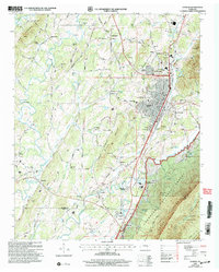
2003 Map of Etowah
USGS Topo · Published 2004About this map
Etowah serves as the central hub of this landscape, its grid-like urban core defined by the prominent corridor of the L & N RR. The town’s social fabric is visible through institutions like Woods Memorial Hospital, the Jr High Sch, and the East and West Sch. To the north and south, smaller settlements and neighborhoods like Williamsburg, North Etowah, and Belleview Estates flank the railroad, which historically drove the region's economy and development.
Find a feature on this map
84 named features on this map. Tap any name to fly to it.
Don’t see what you’re looking for? This feature index may not catch every label — zoom into the map to look around manually.
Map Details
Editions of this 2003 Etowah Map
This is the sole edition of this map. No revisions or reprints were ever made.
Other maps of this area

1886 · Cleveland
USGS Topo · 1:125,000

1892 · Cleveland
USGS Topo · 1:125,000

1893 · Murphy
USGS Topo · 1:125,000

1895 · Cleveland
USGS Topo · 1:125,000

1901 · Cleveland
USGS Topo · 1:125,000

1914 · Murphy
USGS Topo · 1:125,000

1934 · Mecca
USGS Topo · 1:24,000
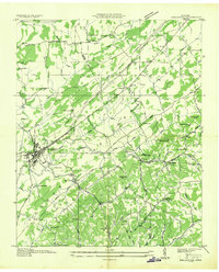
1934 · Englewood
USGS Topo · 1:24,000

1935 · Tellico
USGS Topo · 1:48,000
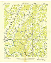
1935 · Calhoun
USGS Topo · 1:24,000