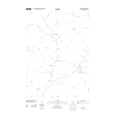
2013 Map of Ettrick
USGS Topo · Published 2013About this map
The community of Ettrick serves as the focal point of this Trempealeau County landscape, situated at the confluence of several watercourses and major local thoroughfares. The terrain is defined by its dramatic coulee geography, with deep valleys like Smikrud Coulee, Linderund Coulee, and Abraham Coulee cutting through the upland ridges. These landforms dictate the settlement patterns and road networks, as seen in the linear distribution of Upper French Creek and Frenchville along the primary drainage of French Creek. Further south, Johnson Peak provides a significant topographic landmark overlooking the wider valley of Beaver Creek. Small historic locales such as Iduna and Chapultepee are mapped along the narrow ridge roads and creek beds, illustrating the traditional rural organization of this Driftless Area region. The mapping of numerous local lanes, such as Brekke Ridge Rd and Skorstad Rd, provides a high-resolution view of the area's contemporary rural structure and land use.
Find a feature on this map
67 named features on this map. Tap any name to fly to it.
Don’t see what you’re looking for? This feature index may not catch every label — zoom into the map to look around manually.
Map Details
Editions of this 2013 Ettrick Map
This is the sole edition of this map. No revisions or reprints were ever made.
Other maps of this area

1926 · North Bend
USGS Topo · 1:62,500

1926 · Whitehall
USGS Topo · 1:62,500

1927 · Blair
USGS Topo · 1:62,500

1929 · Whitehall
USGS Topo · 1:62,500

1929 · Galesville
USGS Topo · 1:62,500

1929 · North Bend
USGS Topo · 1:62,500

1953 · Eau Claire
USGS Topo · 1:250,000

1958 · Eau Claire
USGS Topo · 1:250,000

1964 · Eau Claire
USGS Topo · 1:250,000
1968 · Blair
USGS Topo · 1:62,500